
Scenic Road Overview and Route Map
About the Scenic Road
- Road name: Baekri Seomseomgil
- Purpose of designation: To develop an internationally renowned scenic road by connecting the outstanding coastal scenery and island attractions along a 100-ri (39.2 km) corridor linking 10 islands via 11 bridges.
- Starting point: 261-3 Ucheon-ri, Yeongnam-myeon, Goheung-gun (Paryeong Bridge Smart Rest Complex, Goheung-gun)
- Ending point: 22-1 Baekya-ri, Hwajeong-myeon, Yeosu-si (Baekya Lighthouse three-way intersection on Baekyado Island, Hwajeong-myeon, Yeosu-si)
- Length: 23.0 km (National Route 77)* After the Hwatae–Baegya section of National Route 77 is completed in 2028, a proposal is planned to extend the designated scenic road to 39.2 km.
- Road authority: Iksan Regional Office of Construction and Management, Ministry of Land, Infrastructure and Transport
※ What is a designated scenic road?
A scenic road is a road with outstanding natural scenery along its route and a wealth of distinctive attractions nearby. It is designated by the Ministry of Land, Infrastructure and Transport following assessment and deliberation under Article 48-2 of Korea’s Road Act.Baekri Seomseomgil became the first road in Jeollanam-do to receive this designation in November 2025.
A scenic road is a road with outstanding natural scenery along its route and a wealth of distinctive attractions nearby. It is designated by the Ministry of Land, Infrastructure and Transport following assessment and deliberation under Article 48-2 of Korea’s Road Act.Baekri Seomseomgil became the first road in Jeollanam-do to receive this designation in November 2025.
Full Route Map
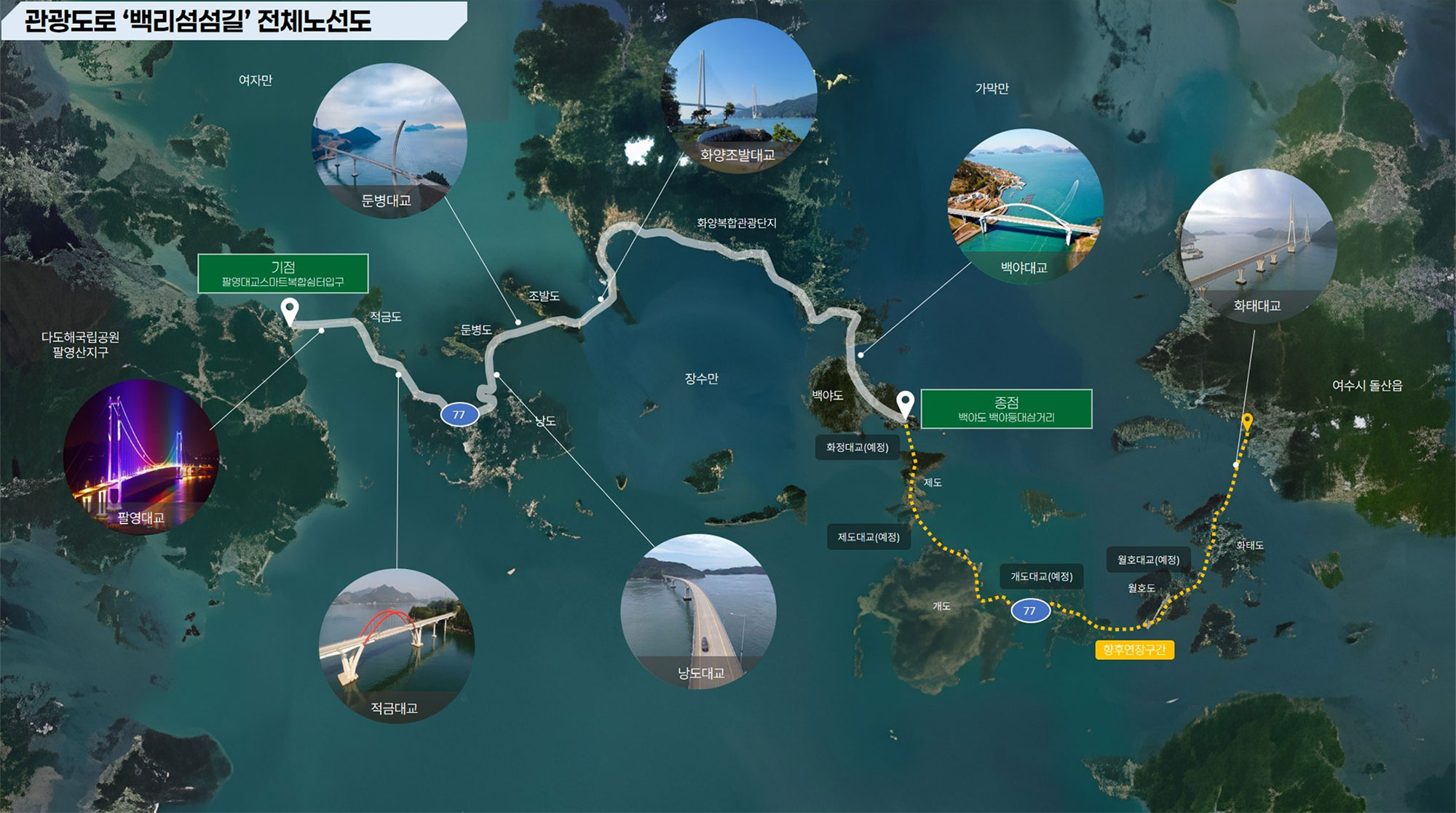
Scenic viewpoints: 7 locations
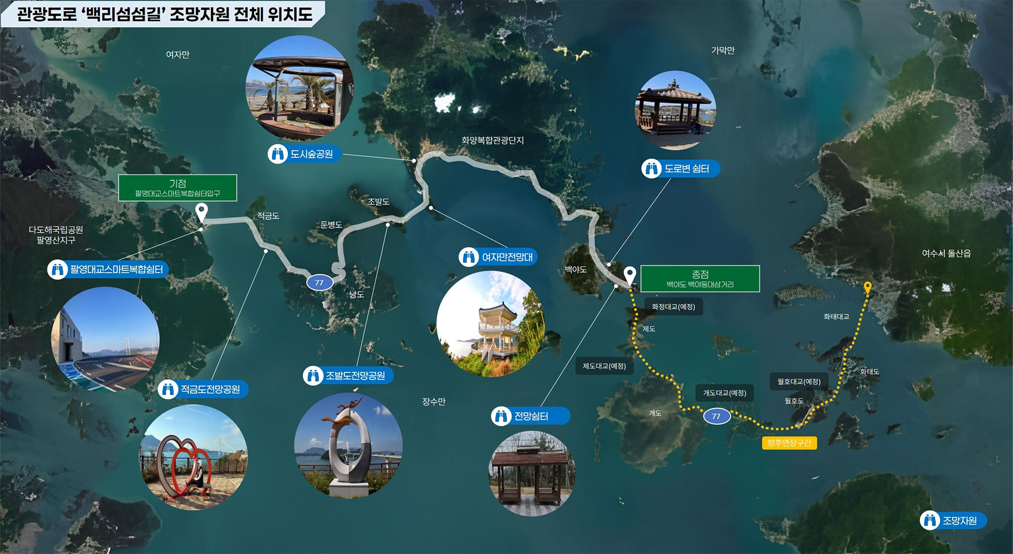
Visitor attractions: 39 locations

Scenery along the Road
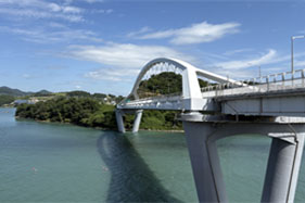 Source: Korea Road Association
<Baegyadaegyo Bridge and Sunset over the Dadohae Archipelago>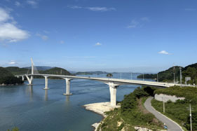 Source: Korea Road Association
<Jobaldo Island> Source: © Korea Tourism Organization Photo Korea / Kim Ji-ho
<Dunbyeongdaegyo Bridge> Source: Korea Road Association
<Palyeongdaegyo Bridge>
Baekri Seomseomgil: Open Sections and Construction Status

